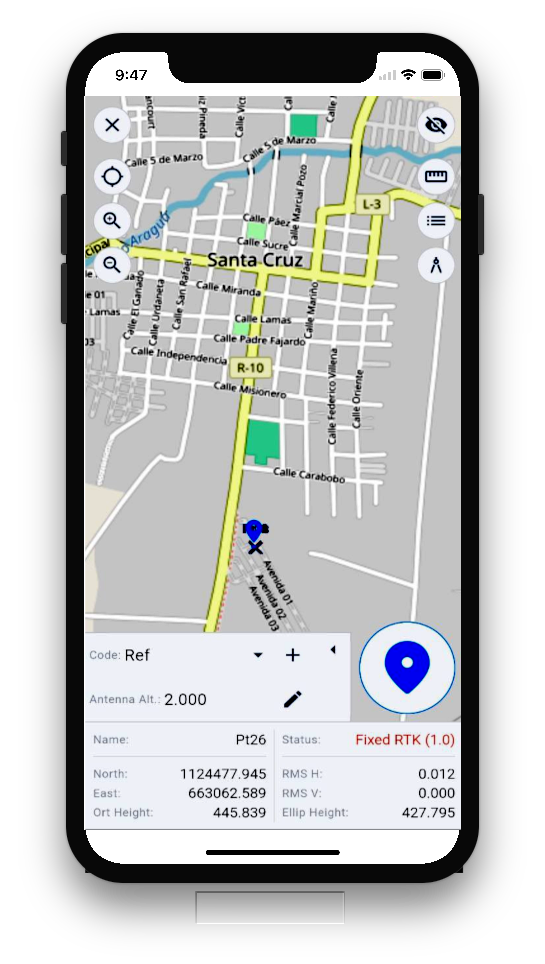
Xmapper
Software
Application for mobile devices
mobile Affordable solution for collecting position data with GPS GNSS RTK receivers.
Xmapper software can be installed on Android mobile devices or rugged data collectors available on the market.
Advanced Features
With Xmapper, you have the tools necessary to record the data generated by a GNSS receiver during field measurement
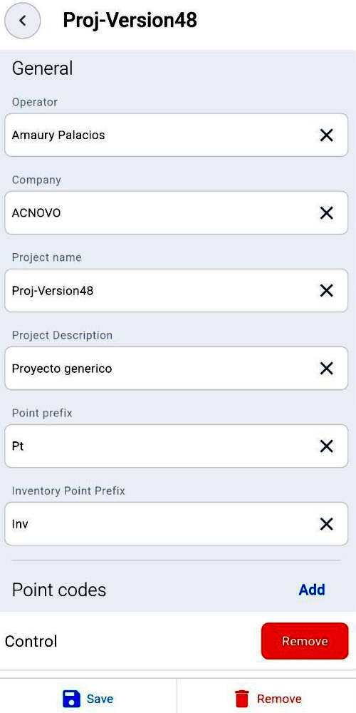
Project Creation
You can create projects where the collected data will be stored. Each project must have a name and other important information that describes the work, allowing you to organize the information efficiently.
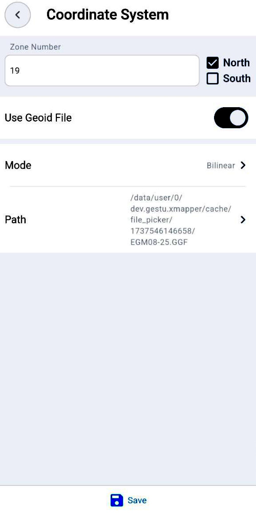
Coordinate System
Easily select the UTM coordinate system for the area to be measured.
Create Transverse Mercator projection system using custom parameters.
Upload your preferred GGA geoid file to optimize orthometric heights.
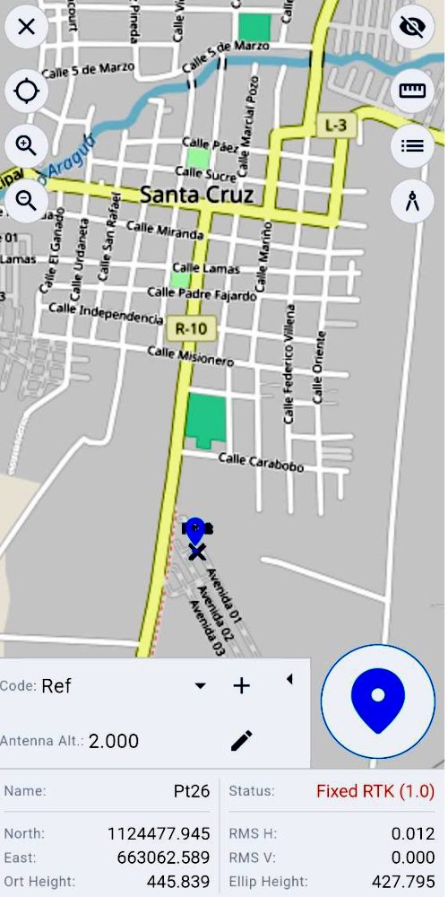
Point Measurement
This feature allows you to record all the information associated with the position of the equipment at a point, such as: name, north, east, elevation, description, accuracy, both in the UTM system and in geographic coordinates.
Inventory Creation
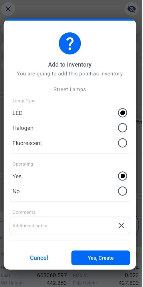
It is a very useful tool for those who need to make inventories, as it allows you to create your own custom template with the information to be collected. For example, when measuring a point, multiple descriptions previously created by a client must be selected.
Inventory Creation
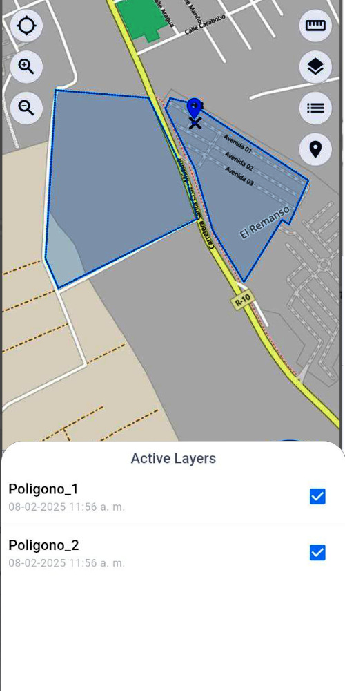
This tool allows you to import KMZ files created in Google Earth, which is very useful for showing measurement areas that delimit an area, such as property boundaries, land subdivisions, etc. Each file can be activated or deactivated in layers.
Inventory Creation
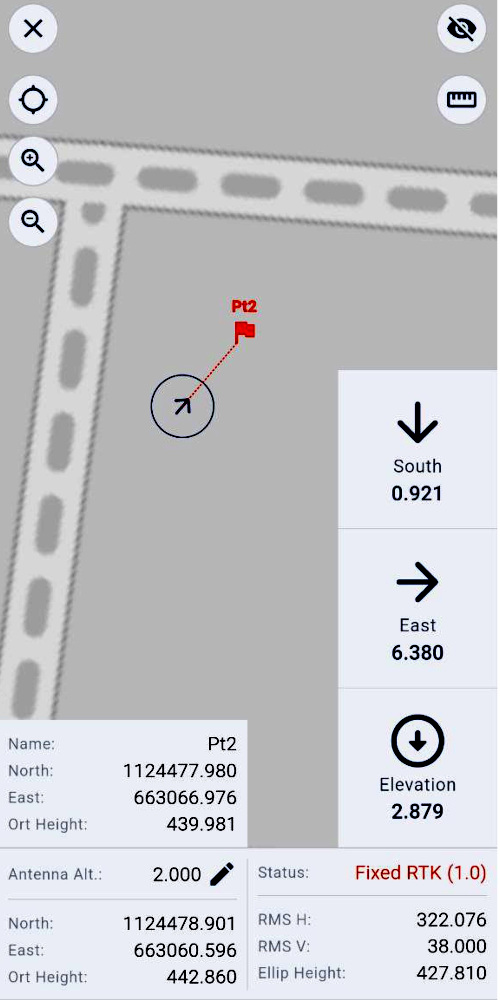
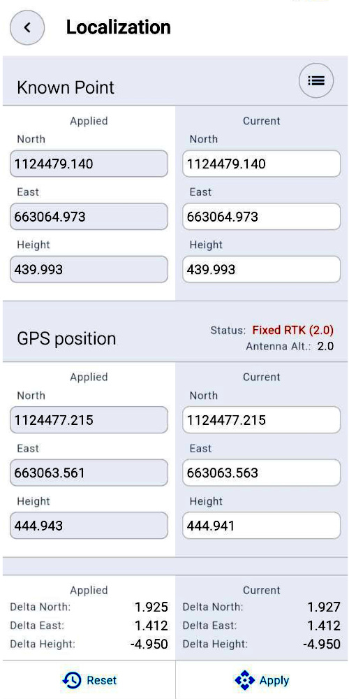
It is a tool that allows the user to align with a local coordinate system using the GNSS RTK receiver. This method is generally used to tie to a known or previously measured position.
You can pick a point from point list or write manually.
PDF Reports
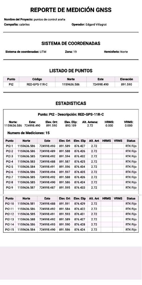
This feature allows you to generate PDF reports of the points that were recorded as control points or data that was measured with the inventory creation function.
The generated file can be easily shared via WhatsApp, Telegram, email, or downloaded to the local memory of the mobile device.
Bluetooth connection
Connect your device using mobile device Bluetooth.
NMEA messages
Xmapper reads the receiver NMEA messages, including GGA, GSA, GSV, GST, GLL, RMC, and VTG.
NTRIP
Connect to your Network RTCM3 correction services using mobile internet or WiFi
Many GNSS receivers have the ability to connect with Bluetooth and send NMEA data, ensuring compatibility with our app.
Whether you use high-end professional equipment or low-cost receivers, our app can read and process the NMEA messages needed to record all your field data.
Experience effortless integration and improved performance with Xmapper.

Xmapper is affordable and easy to acquire!
– Annual Subscription: Only $60 per year.
– Additional Licenses: $25 for each additional device using the same email account.

